1. North America, Treaty of Versailles, 1783
By the Treaty of Versailles, 1783, the independence of the 13
colonies forming the United States was acknowledged. The boundary between
the United States and British North America was to run, following various
rivers, lakes and latitude 45°, west to the Lake of the Woods and then to
the Mississippi.

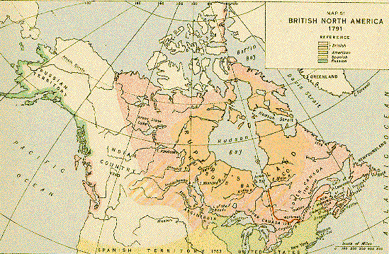
2. British North America, 1791
By the Constitutional Act of 1791 the province of Quebec was
divided into Upper and Lower Canada. After the American Revolution many
United Empire Loyalists left the United States and emigrated to Nova
Scotia, New Brunswick and Quebec. The division into Upper and Lower Canada
gave the Loyalists who settled west of the Ottawa River the chance to
organize and develop along their own lines.
3. British North America, 1818
By the treaty of 1818 with the United States, the international
boundary was to run from the northwest corner of the Lake of the Woods due
south to the 49th parallel and along it to the Rocky Mountains.

4. British North America, 1849
By the treaty of 1842 the boundary between the United States and
the British territories was settled in the east; and by the treaty of 1846
the 49th parallel was agreed upon as the boundary from the Rocky Mountains
to the Pacific. In the east, in 1840, Upper and Lower Canada were reunited
as the province of Canada.

5. British North America, 1866
British North America approaching Confederation (1867).

6. Dominion of Canada, 1873
In 1867 the British North America Act brought together the
provinces of Canada, divided into Ontario and Quebec, Nova Scotia and New
Brunswick, to form the Dominion of Canada. In 1869, having acquired the
rights from the Hudson's Bay Company, the Dominion transformed the former
Rupert's Land and the area beyond the Rocky Mountains into the North West
Territories. In 1870, the old Red River settlement joined the Dominion as
the province of Manitoba. In 1872 British Columbia joined the union. In
1873 Prince Edward Island joined Confederation.

7. Dominion of Canada, 1905
In 1905 Alberta and Saskatchewan became provinces of the Dominion.

8. Dominion of Canada, 1949
The Province of Newfoundland joined Confederation on March 31, 1949.

9. Dominion of Canada, 1999
The Northwest Territories is divided in half, creating a new Territory of Nunavut on April 1, 1999.

10. Dominion of Canada, 2001
On December 6, 2001, an amendment to the Constitution Act officially approved a name change from the easternmost province of Newfoundland to the Province of Newfoundland and Labrador. The move for change began in the early 1990s to provide "symbolic but important recognition of Labrador's status as a full and vital partner within the province, with its own unique geography, history and culture."

11. Dominion of Canada, 2003
On April 1, 2003, the Yukon Act came into force, devolving many powers to the territory that previously were handled by the federal government. Part of the changes enacted was to drop "Territory" from its official name.

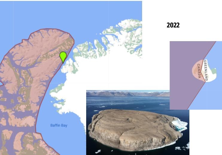
11. Dominion of Canada, 2022
On June 14, 2022, Canada and Denmark reached an agreement about Hans Island, officially splitting its ownership between Nunavut and Greenland.
SOURCE: National Archives of Canada
|